Maps of Bangladesh
Political, Physical, Geological, Archeological and other types of map of Bangladesh.
Google AdSense Code
Tuesday, August 31, 2010
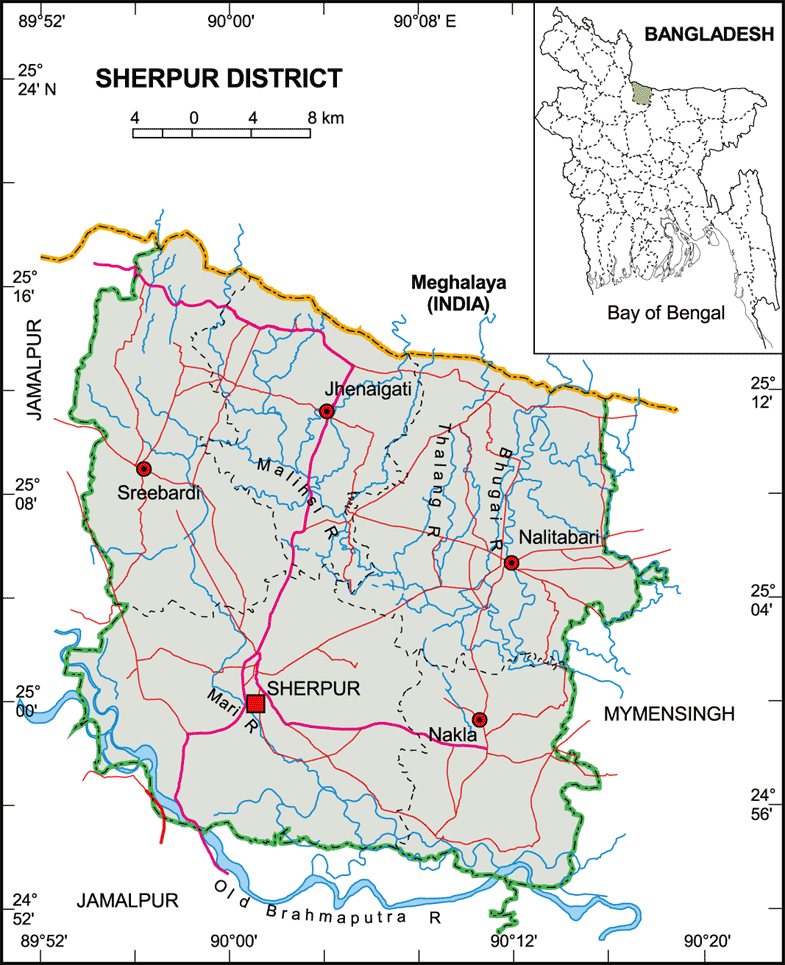
Political Map of Sherpur District
Sherpur District Map
শেরপুর জেলা মানচিত্র
(click the map for larger version)
Source:
http://www.banglapedia.org
Related Post:
Map of Jamalpur District
Map of Mymensing District
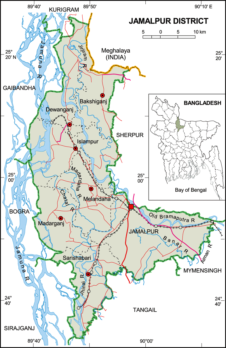
Political Map of Jamalpur District
Jamalpur District Map
(click the map for larger version)
Source:
http://www.banglapedia.org
Related Post:
Map of Sherpur District
Map of Mymensing District
Map of Tangail District
Political Map of Manikganj District
Manikganj District Map
(click the map for larger version)
Source:
http://www.banglapedia.org
Related Post:
Map of Dhaka District
Map of Tangail District
Political Map of Narayanganj District
Narayanganj District Map
নারায়নগঞ্জ জেলা মানচিত্র
(click the map for larger version)
Source:
http://www.banglapedia.org/httpdocs/Maps/MN_0057.GIF
Related Maps:
Dhaka District Map
Narshingdi District Map
Gazipur District Map
Munshiganj District Map
Comilla District Map
Brahmanbaria District Map
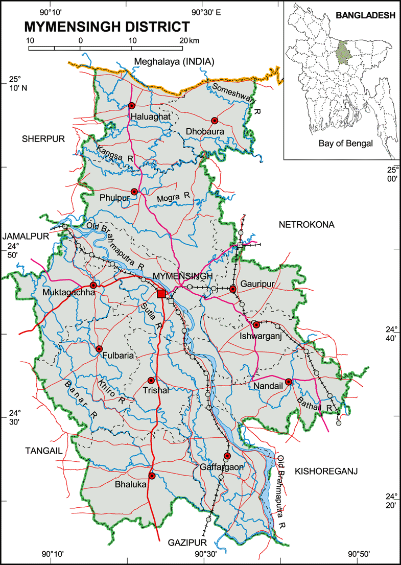
Political Map of Mymensing District
Mymensing District Map
(click the map for larger version)
Source:
http://www.banglapedia.org
Related Post:
Map of Jamalpur District
Map of Tangail District
Monday, August 30, 2010
Political Map of Bhuapur Upazila
Bhuapur Upazila Map (English Version)
(click the map for larger version)
Bhuapur Upazila Map (Bangla Version)
ভূয়াপুর উপজেলা-এর মানচিত্র
(click the map for larger version)
Source:
Banglape
dia
Related Post:
Tangail District Map
Gopalpur Upazila Map
Ghatail Upazila Map
Kalihati Upazila Map
Alternative Spellings/Names:
Bhuiyanpur, Bhuiapur, Bhuapur Thana, Bhuiyanpur Thana, Vuapur
Newer Posts
Older Posts
Home
Subscribe to:
Posts (Atom)


