Map of Bangladesh (English Version)
(click the map for larger version)

Map of Bangladesh (Bangla Version)
(click the map for larger version)
বাংলাদেশ-এর মানচিত্র
বাংলাদেশ-এর মানচিত্র

Related Map:
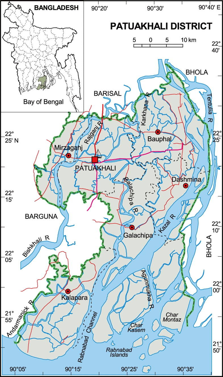
 Source: http://bpedia.org
 Source: http://bpedia.org
 Source: http://bpedia.org
 Source: http://bpedia.org
 Source: http://bpedia.org

